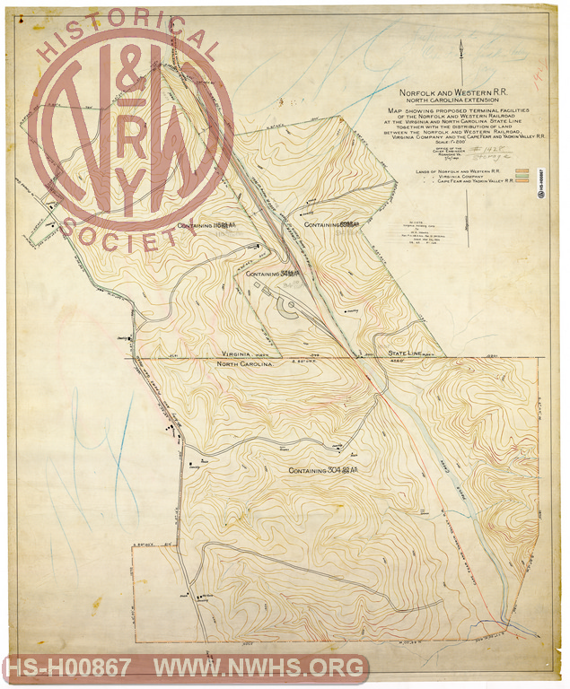
| Locator | Hist Soc - HS-H00867 | Type | Drawing | Doc Number | 1428 | |
|---|---|---|---|---|---|---|
| Description | N&W North Carolina Extension, Map Showing Proposed Terminal Facilities of the N&W RR at the Virginia and North Carolina State Line together with the distribution of land between the N&W RR, Virginia Company and the Cape Fear and Yadkin Valley RR | |||||
| Notes | Scale 1"=200' | |||||
| Date | 07/10/1890 | Revision Date | 03/26/1926 | |||
| Author | N&W RR - Office of Chief Engr | Accession | 2009.001 : NS Corp/Va Tech Collection | |||

|
||
Size: 32in x 39in (81cm x 98cm) |
| Related | Bound Volume - BV-E00001 | Copy, Index of Maps, W.W. Coe Incomplete index to early engineering drawings. Drawing numbers range from single digits into the high 2000s. Not all drawing numbers in that range listed. ~116 pages plus cover, several pages blank. |
|
| Related | 1428 | Hist Soc - HS-D04908 | Map of Lands of the Norfolk and Western R.R. Co. in Carroll County, Virginia adjacent to the North Carolina State Line Scale 1"=200' |
| Related | 1428 | Hist Soc - HS-D04909 | Map of Lands of the Virginia Company in Carroll County Virginia adjacent to the North Carolina State Line Scale 1"=200', "Leased to H.F. Niston Apr. 1923", N_11079 to W.A. Hawks 3/26/1926 |
| Related | 1428 | Hist Soc - HS-CC02522 | Land to be Deeded to the Norfolk & Western Railroad Co. (Adjacent to NC/VA state line) |
| Related | 1245 | Hist Soc - HS-K10648 | Cape Fear & Yadkin Valley Railway, Map of location from Mt Airy to Virginia line, Connecting with Norfolk & Western preliminary on Naked Run |
| Structure | Land |
| Company | N&W RR - Norfolk & Western Railroad |
| Company | Virginia Company, The |
| Company | Cape Fear & Yadkin Valley |
| Division | N&W RR - North Carolina |