| Locator | Hist Soc - HS-CC02522 | Type | Drawing | Doc Number | 1428 | |
|---|---|---|---|---|---|---|
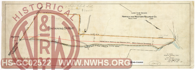
| Description | Land to be Deeded to the Norfolk & Western Railroad Co. (Adjacent to NC/VA state line) | |||||
| Date | 07/15/1890 | Revision Date | 04/26/1926 | |||
| Author | N&W Railroad | Accession | 2009.001 : NS Corp/Va Tech Collection | |||

|
||
Size: 25in x 9in (64cm x 23cm) |
| Related | 1428 | Hist Soc - HS-H00867 | N&W North Carolina Extension, Map Showing Proposed Terminal Facilities of the N&W RR at the Virginia and North Carolina State Line together with the distribution of land between the N&W RR, Virginia Company and the Cape Fear and Yadkin Valley RR Scale 1"=200' |
| Related | 1428 | Hist Soc - HS-D04908 | Map of Lands of the Norfolk and Western R.R. Co. in Carroll County, Virginia adjacent to the North Carolina State Line Scale 1"=200' |
| Related | 1428 | Hist Soc - HS-H00868 | Untitled, undated Map of Lands of the Virginia Company in Carroll County Virginia adjacent to the North Carolina State Line References N-11079, Virginia Holding Corp. to W.A. Hawks, 2 parcels. |
| Related | 1428 | Hist Soc - HS-D04909 | Map of Lands of the Virginia Company in Carroll County Virginia adjacent to the North Carolina State Line Scale 1"=200', "Leased to H.F. Niston Apr. 1923", N_11079 to W.A. Hawks 3/26/1926 |
| Structure | Land |
| Structure | Land - To be Deeded |
| Company | N&W RR - Norfolk & Western Railroad |
| Company | Virginia Holding Corporation |
| Division | N&W RR - Radford - North Carolina Br |