| Locator | Hist Soc - HS-D04689 | Type | Drawing | Doc Number | 1222 | |
|---|---|---|---|---|---|---|
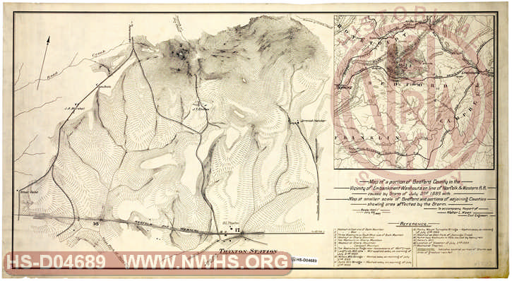
| Description | Map of a portion of Bedford County in the Vicinity of Embankment Washouts on Line of N&W RR caused by Storm of July 22nd 1889 with Map at smaller scale of Bedford and portions of adjoining Counties show area affected by the Storm | |||||
| Notes | Scale 1"=400', "To accompany Report of Walter L. Keen Civil Engineer" | |||||
| Date | 07/22/1889 | Revision Date | ||||
| Author | Accession | 2009.001 : NS Corp/Va Tech Collection | ||||
|
|

|
|
Size: 33in x 18in (83cm x 46cm) |
| Related | Bound Volume - BV-E00001 | Copy, Index of Maps, W.W. Coe Incomplete index to early engineering drawings. Drawing numbers range from single digits into the high 2000s. Not all drawing numbers in that range listed. ~116 pages plus cover, several pages blank. |
| City | Thaxton - VA |
| Company | N&W RR - Norfolk & Western Railroad |
| Event | Derailment |