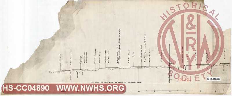
| Locator | Hist Soc - HS-CC04890 | Type | Drawing | Doc Number | 1212 | |
|---|---|---|---|---|---|---|
| Description | Profile of the Guyandot River from the Ohio to Gilbert Creek, Joseph Gill, 25 Jan 1849 | |||||
| Notes | Copied from the original June 1st, 1887. middle section of damaged three part drawing. Title from W.W. Coe Indedx of Maps (BV-E00001): "Guyandot River - map and profile of from the Ohio River to Gilbert's Creek - by Joseph Gill - 1/25/1849". |
|||||
| Date | 01/25/1849 | Revision Date | ||||
| Author | N&W Railroad | Accession | 2009.001 : NS Corp/Va Tech Collection | |||

|
||
Size: 29in x 12in (74cm x 31cm) |
| Parent | Bound Volume - BV-E00001 | Copy, Index of Maps, W.W. Coe Incomplete index to early engineering drawings. Drawing numbers range from single digits into the high 2000s. Not all drawing numbers in that range listed. ~116 pages plus cover, several pages blank. |
|
| Related | 1212 | Hist Soc - HS-CC04889 | Profile of the Guyandot River from the Ohio to Gilbert Creek, Joseph Gill, 25 Jan 1849 Copied from the original June 1st, 1887. Ohio end of damaged three part drawing. Title from W.W. Coe Indedx of Maps (BV-E00001): "Guyandot River - map and profile of from the Ohio River to Gilbert's Creek - by Joseph Gill - 1/25/1849". |
| Related | 1212 | Hist Soc - HS-S00198 | Profile of the Guyandotte River from it's Junction with the Ohio at Guyandotte to Gilbert Creek Presumably redrawn from tracing paper version copied from the original June 1st, 1887. Title from W.W. Coe Index of Maps (BV-E00001): "Guyandot River - map and profile of from the Ohio River to Gilbert's Creek - by Joseph Gill - 1/25/1849". |
| Related | 1212 | Hist Soc - HS-G01820 | Map of the Guyandotte River from it's Junction with the Ohio at Guyandotte to Gilbert Creek Title from W.W. Coe Index of Maps (BV-E00001): "Guyandot River - map and profile of from the Ohio River to Gilbert's Creek - by Joseph Gill - 1/25/1849". |
| Related | 1212 | Hist Soc - HS-F03314 | Guyandot River. Surveyed under direction of Major W.E. Merrill, U.S.E. 1874 Scale 1"=1miles. Title from W.W. Coe Indedx of Maps (BV-E00001): "Guyandot River - map and profile of from the Ohio River to Gilbert's Creek - by Joseph Gill - 1/25/1849" |
| Related | 1212 | Hist Soc - HS-CC04891 | Profile of the Guyandot River from the Ohio to Gilbert Creek, Joseph Gill, 25 Jan 1849 Copied from the original June 1st, 1887. Gillbert Creek end of damaged three part drawing. Title from W.W. Coe Indedx of Maps (BV-E00001): "Guyandot River - map and profile of from the Ohio River to Gilbert's Creek - by Joseph Gill - 1/25/1849". |
| Structure | River |
| Company | N&W RR - Norfolk & Western Railroad |