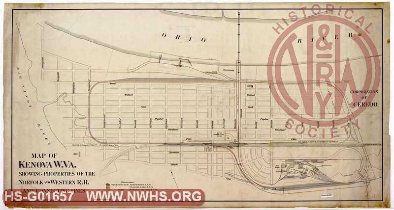
| Locator | Hist Soc - HS-G01657 | Type | Drawing | Doc Number | 1811 | |
|---|---|---|---|---|---|---|
| Description | Map of Kenova W.Va. showing properties of the Norfolk and Western R.R. and connecting lines | |||||
| Date | 07/01/1892 | Revision Date | ||||
| Author | N&W Railroad | Accession | 2009.001 : NS Corp/Va Tech Collection | |||

|
||
Size: 59in x 31in (149cm x 80cm) |
| Related | Bound Volume - BV-E00001 | Copy, Index of Maps, W.W. Coe Incomplete index to early engineering drawings. Drawing numbers range from single digits into the high 2000s. Not all drawing numbers in that range listed. ~116 pages plus cover, several pages blank. |
|
| Related | 1811 | Hist Soc - HS-E02364 | Kenova West Virginia at the confluence of the Ohio and Big Sandy Rivers the point at which the three states of West Virginia, Ohio, and Kentucky Meet Showing rights of way of N&W R.R. June 1891 |
| City | Kenova - WV |
| City | Ceredo - WV |
| Company | C&O - Chesapeake & Ohio |
| Company | N&W RR - Norfolk & Western Railroad |
| Company | Huntington and Big Sandy RR |