| Locator | Hist Soc - HS-K10626 | Type | Drawing | Doc Number | 866 | |
|---|---|---|---|---|---|---|
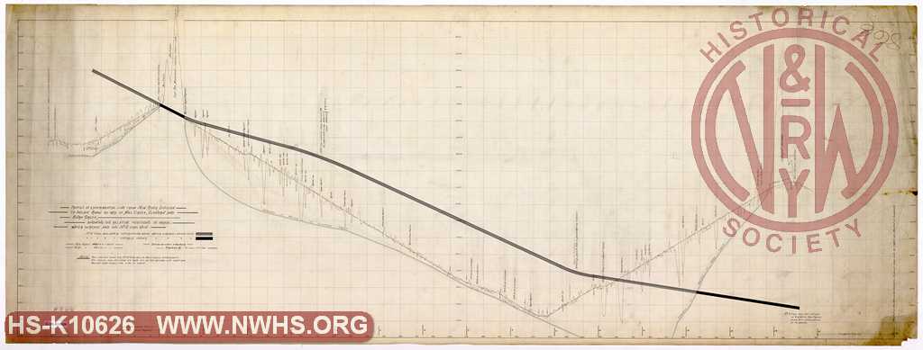
| Description | Profile of Experimental Line from New River Division to Indian Ridge by way of Mill Creek, Elkhorm and Burk Creek showing the relative positions of grade, water surface and the No. 3 Coal Vein | |||||
| Notes | Title in BV-E00001 - W.W. Coe, Index of Maps: "W Va & Ohio surveys - profile of experimental line from New River Division to Indian Ridge via Mill Creek, Elkhorn & Burk Creek, showing relative positions of grade, water surface & #3 Coal Vein; also line via Peters Gap" |
|||||
| Date | Revision Date | |||||
| Author | N&W Railroad | Accession | 2009.001 : NS Corp/Va Tech Collection | |||

|
||
Size: 69in x 26in (175cm x 66cm) |
| Parent | Bound Volume - BV-E00001 | Copy, Index of Maps, W.W. Coe Incomplete index to early engineering drawings. Drawing numbers range from single digits into the high 2000s. Not all drawing numbers in that range listed. ~116 pages plus cover, several pages blank. |
|
| Related | 866 | Hist Soc - HS-K10627 | Profile of Location from End of Track of the Flat Top Extension to Peters Gap and of Experimental Line from Peters to mouth of Rockcastle Creek, showing the relative positions of grade, water surface and the No. 3 Coal Bed Title in BV-E00001 - W.W. Coe, Index of Maps: "W Va & Ohio surveys - profile of experimental line from New River Division to Indian Ridge via Mill Creek, Elkhorn & Burk Creek, showing relative positions of grade, water surface & #3 Coal Vein; also line via Peters Gap" |
| Company | N&W RR - Norfolk & Western Railroad |
| Division | N&W RR - Ohio Extension |