| Locator | Hist Soc - HS-C04551 | Type | Drawing | Doc Number | 1991 | |
|---|---|---|---|---|---|---|
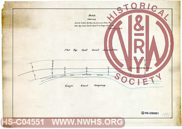
| Description | Sketch showing land taken by North Fork Extension from Flat Top Coal Land Association & Crozer Land Co. | |||||
| Notes | Scale 1"=50', No date | |||||
| Date | Revision Date | |||||
| Author | Accession | 2009.001 : NS Corp/Va Tech Collection | ||||

|
||
Size: 17in x 12in (43cm x 30cm) |
| Related | Bound Volume - BV-E00001 | Copy, Index of Maps, W.W. Coe Incomplete index to early engineering drawings. Drawing numbers range from single digits into the high 2000s. Not all drawing numbers in that range listed. ~116 pages plus cover, several pages blank. |
|
| Related | 1991 | Hist Soc - HS-C04552 | Sketch showing land taken by North Fork Extension from Flat Top Coal Land Association & Crozer Land Co. Scale 1"=50', No date |
| Related | 1991 | Hist Soc - HS-CC02418 | Sketch showing land taken by North Fork Extension from Flat Top Coal Land Association & Crozer Land Co. Scale 1"=50', No date |
| Related | 1991 | Hist Soc - HS-C04553 | Sketch showing land taken by North Fork Extension from Flat Top Coal Land Association & Crozer Land Co. Scale 1"=50', No date |
| Related | 1991 | Hist Soc - HS-B24432 | Sketch showing land taken by North Fork Extension from Flat Top Coal Land Association & Crozer Land Co. Scale 1"=50', No date |
| Related | 1991 | Hist Soc - HS-B24433 | Sketch showing land taken by North Fork Extension from Flat Top Coal Land Association & Crozer Land Co. Scale 1"=50', No date |
| City | Northfork - WV |
| Structure | Right of Way |
| Company | N&W Rwy - Norfolk & Western Railway |
| Company | Crozer Land Co. |
| Company | Flat Top Coal Land Assocation |