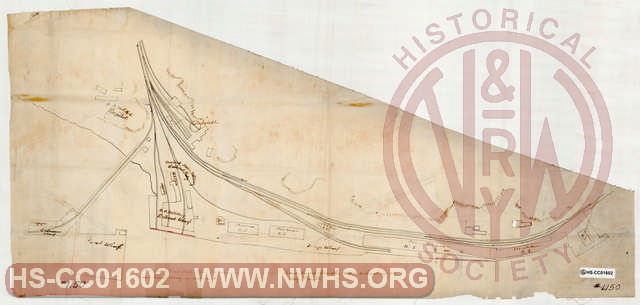
| Locator | Hist Soc - HS-CC01602 | Type | Drawing | Doc Number | 1150 | |
|---|---|---|---|---|---|---|
| Description | "The South Side Railroad Co wharfs and land", "Rail road tracks and wharfs at City Point" | |||||
| Notes | No Date, hard to read. Title from WW Coe Index of Maps: "City Point - property as used by US Government during late war (civil war)". | |||||
| Date | Revision Date | |||||
| Author | Accession | 2008.001 : Roanoke Chapter - NRHS | ||||
|
|

|
|
Size: 32in x 15in (81cm x 39cm) |
| Parent | Bound Volume - BV-E00001 | Copy, Index of Maps, W.W. Coe Incomplete index to early engineering drawings. Drawing numbers range from single digits into the high 2000s. Not all drawing numbers in that range listed. ~116 pages plus cover, several pages blank. |
| City | City Point - VA |
| Structure | Turntable |
| Company | SS RR - South Side RR |