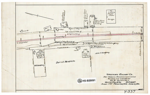
| Locator | Hist Soc - HS-B20091 | Type | Drawing | Doc Number | Y-337 | |
|---|---|---|---|---|---|---|
| Description | VGN, Map showing encroachement of cut of slopes on lands of W.R. Humphrey, West of Pax, W.Va. MP 409.4 | |||||
| Notes | Scale 1"=50' | |||||
| Date | 06/03/1916 | Revision Date | ||||
| Author | Accession | 2005.004 : Library of Virginia | ||||

|
||
Size: 13in x 8in (34cm x 21cm) |
| City | Pax - WV |
| Structure | Right of Way - Encroachment |
| Structure | Land - Encroachment |
| Company | VGN Rwy - Virginian Railway |