| Locator | Hist Soc - HS-H00630 | Type | Drawing | Doc Number | 13459-C | |
|---|---|---|---|---|---|---|
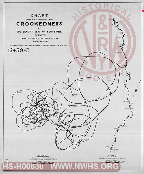
| Description | Chart Showing Alignment and CROOKEDNESS of Big Sandy River and Tug Fork between Catlettsburg, KY and Sprigg, WV | |||||
| Notes | Diagram showing course of stream, all curves plotted to the right. | |||||
| Date | 08/31/1945 | Revision Date | ||||
| Author | N&W Rwy - Office Chief Engr | Accession | 2005.004 : Library of Virginia | |||

|
||
Size: 34in x 41in (86cm x 104cm) |
| Structures Indexes | |
|---|---|
| Category | Type |
| River | |
| River | Canalization |
| Railroads and Companies | |
|---|---|
| Abbreviation | Name |
| N&W Rwy | Norfolk & Western Railway |