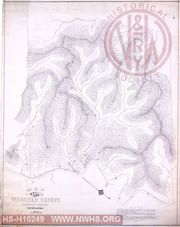
| Locator | Hist Soc - HS-H10249 | Type | Drawing | |||
|---|---|---|---|---|---|---|
| Description | Map of the Warfield Estate, Martin County KY | |||||
| Notes | Scale 40 Rods to the inch. Shows locations of coal openings. Undated. |
|||||
| Date | Revision Date | |||||
| Author | Accession | 2009.001 : NS Corp/Va Tech Collection | ||||

|
||
Size: 35in x 44in (88cm x 112cm) |
| Cities Indexes | |
|---|---|
| City | State |
| Warfield | KY |
| Structures Indexes | |
|---|---|
| Category | Type |
| Land | |
| Land | Coal |
| Related Documents | |||
|---|---|---|---|
| Type | Number | Locator | Description |
| Related | Hist Soc - HS-E10654 | Map of the Warfield Property, Martin County KY | |