| Locator | Hist Soc - HS-D02664 | Type | Drawing | |||
|---|---|---|---|---|---|---|
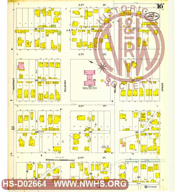
| Description | Map of Ironton, Oh showing lots, streets industries, railroads etc. South 5th to 7th streets, Chestnut to Spruce St,. page No. 16 | |||||
| Date | 11/01/1900 | Revision Date | ||||
| Author | N&W Rwy - Motive Power | Accession | 2005.004 : Library of Virginia | |||

|
||
Size: 23in x 26in (59cm x 65cm) |
| Cities Indexes | |
|---|---|
| City | State |
| Ironton | OH |
| Structures Indexes | |
|---|---|
| Category | Type |
| Land | |
| Land | Lots |
| Related Documents | |||
|---|---|---|---|
| Type | Number | Locator | Description |
| Parent | Hist Soc - HS-D02635 | Ironton, OH - Sanborn map | |